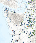
Past Releases summarizes and links to WGS publications released since 2019. This list includes 1:24K geologic maps, fact sheets, seismic hazard information, and more!
2025 | 2024 | 2023 | 2022 | 2021 | 2020 | 2019
2025(top) |
||
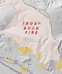 |
New WALERT report for the Thorp Road Fire
On Jan 6 we released a new Wildfire-Associated Landslide Emergency Response Team report for the Thorp Road Fire. Click here to download the report. |
|
2024(top) |
||
 |
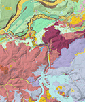
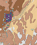
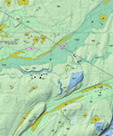
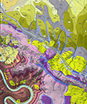
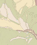
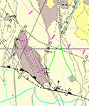
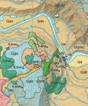
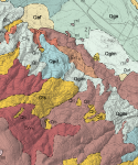
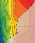
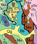
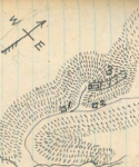
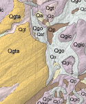
Geologic Map of the Ellensburg South 7.5-minute Quad.
On Dec 23 we released a new geologic map of the Ellensburg South quadrangle at a scale of 1:24,000. Click here to download the map and pamphlet. |
|
 |
Geologic Map of the Eagle Gorge 7.5-minute Quadrangle
On Dec 23 we released a new geologic map of the Eagle Gorge quadrangle at a scale of 1:24,000. Click here to download the map and pamphlet. |
|
 |
Geologic Map of the Eatonville 7.5-minute Quadrangle
On Dec 23 we released a new geologic map of the Eatonville quadrangle at a scale of 1:24,000. Click here to download the map and pamphlet. |
|
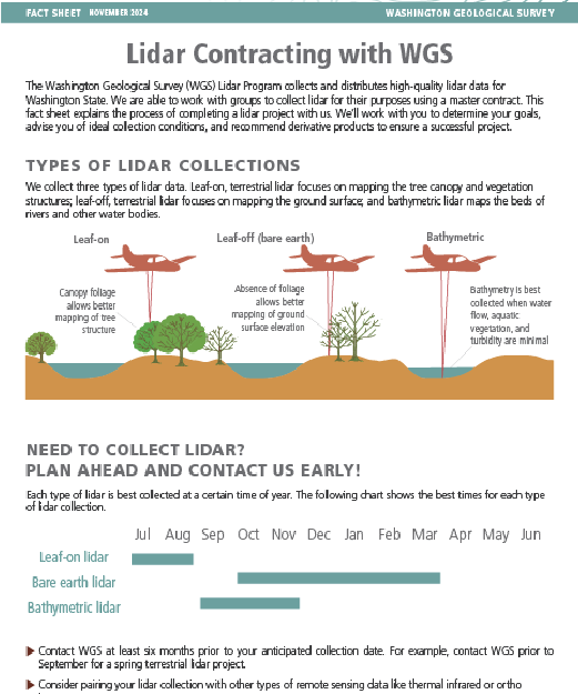 |
Lidar Contracting Fact Sheet
On Dec 20 we released a lidar contracting fact sheet explaining how and when to partner with WGS for lidar collection. Click here to learn more about partnering with WGS to collect lidar. |
|
 |
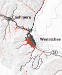
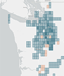
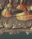
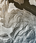
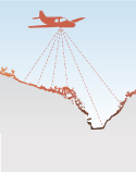
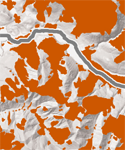
New lidar images for Washington
On Dec 4 we released new lidar images for Washington including The Enchantments and Dry Falls. Click here to read more or here to browse the images. |
|
 |
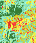
Alluvial Fan Inventory of Chelan County, Washington
On Nov 25 we released a new inventory of alluvial fans in Chelan County. Download the pamphlet here or view the data on the |
|
 |
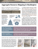
Aggregate Resource Inventory for Spokane County
On Nov 18 we released a new aggregate resource map for Spokane County at a scale of 1:100,000. Click here to download the map and pamphlet. |
|
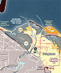 |
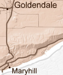
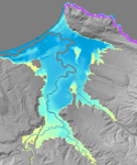
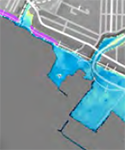
New tsunami evacuation maps
On Oct 14 we released five new tsunami evacuation maps for Dungeness, Kalaloch, Lower Elwha Klallam, Neah Bay, and the Tsoo-Yess River Valley. Access our tsunami evacuation maps here. |
|
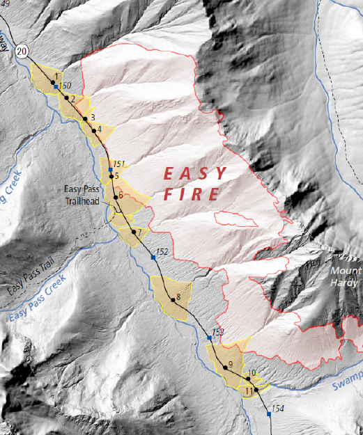 |
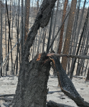
New WALERT report for the Easy Fire
On Oct 3 we released a new Wildfire-Associated Landslide Emergency Response Team report for the Easy Fire. Click here to download the report. |
|
 |
New WALERT report for the Pioneer Fire
On Sept 19 we released a new Wildfire-Associated Landslide Emergency Response Team report for the Pioneer Fire. Click here to download the report. |
|
 |
New WALERT report for the Retreat Fire
On Sept 5 we released a new Wildfire-Associated Landslide Emergency Response Team report for the Retreat Fire. Click here to download the report. |
|
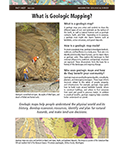 |
New Geologic Mapping Fact Sheet
On May 29, 2024 we released a new fact sheet about geologic mapping in Washington State. Click here to download the fact sheet. Read more about surface geologic mapping on the surface geology page. |
|
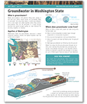 |
New Groundwater Fact Sheet
On May 3, 2024 we released a new fact sheet about groundwater in Washington State. Click here to download the fact sheet. Read more about groundwater resources on the WGS groundwater page. |
|
 |
Updated Washington Tsunami Design Zone
On March 15, 2024 we released an update to the Washington Tsunami Design Zone for the new Washington State Building Code. Read more on the updated WA-TDZ webpage. |
|
 |
Aggregate Resource Inventory for Skagit County
On March 12, 2024 we released a new aggregate resource map for Skagit County at a scale of 1:100,000. Click here to download the map and pamphlet. |
|
2023(top) |
||
 |
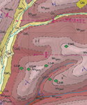
Geologic map of the Bald Hill 7.5-minute quadrangle
On December 27, 2023 we released a new geologic map of the Bald Hill quadrangle at a scale of 1:24,000. Click here to download the map and pamphlet. |
|
 |
Geologic map of the Harts Lake 7.5-minute quadrangle
On December 27, 2023 we released a new geologic map of the Harts Lake quadrangle at a scale of 1:24,000. Click here to download the map and pamphlet. |
|
 |
Geologic map of the Kittitas and E. Kittitas quadrangles
On December 27, 2023 we released a new geologic map of the Kittitas and East Kittitas quadrangles at a scale of 1:24,000. Click here to download the map and pamphlet. |
|
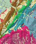 |
Adams Mountain and Hunters quadrangles geologic map
On December 27, 2023 we released a new geologic map of the Adams Mountain and Hunters quadrangles at a scale of 1:24,000. Click here to download the map and pamphlet. |
|
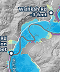 |
New tsunami modeling for southwest Washington rivers
On December 14, 2023 we released a series of new maps showing modeled tsunami inundation and current speed for the Chehalis, Hoquiam, Willapa, and Wishkah Rivers. Click here to check out the publication! |
|
 |
Update to the Columbia Gorge landslide inventory
On November 16, 2023 we released a major update to the landslide inventory for the Columbia Gorge, including new mapping and additional hazards such as rockfall and alluvial fans. Download the publication here. |
|
 |
New interactive map for finding geologic map publications
On November 7, 2023 we released a new interactive map that allows you to search for geologic map publications at a variety of scales by quadrangle name. Click here to check out the map! |
|
 |
New WALERT report for the Sourdough and Blue Lake Fires
On October 2, 2023 we released a new Wildfire-Associated Landslide Emergency Response Team report for the Sourdough and Blue Lake Fires. Click here to download the report. |
|
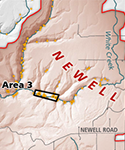 |
New WALERT report for the Newell Road Fire
On September 29, 2023 we released a new Wildfire-Associated Landslide Emergency Response Team report for the Newell Road Fire. Click here to download the report. |
|
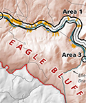 |
New WALERT report for the Eagle Bluff Fire
On September 29, 2023 we released a new Wildfire-Associated Landslide Emergency Response Team report for the Eagle Bluff Fire. Click here to download the report. |
|
 |
New tsunami walk maps and simulation videos
On September 29, 2023 we released 7 new tsunami walk maps and 6 new simulation videos for several communities on the outer coast. The walk maps can be accessed here and the videos here. |
|
 |
New Data Preservation Website released
On July 11, 2023 we released an extensive new website providing access to digital versions of preserved media such as thin sections, field notebooks, and much more. Get started exploring the site here. |
|
 |
New Klickitat alluvial fan mapping publication
On June 26, 2023 we published a new inventory of alluvial fans in Klickitat County. Download the publication here, or view the data on our Geologic Information Portal. |
|
 |
New Klickitat alluvial fan story map
On June 26, 2023 we published a new story map about the intersection of wildfire and alluvial fans in Klickitat County, to accompany a new report and new alluvial fan mapping. |
|
 |
Intermediate-scale surface geology update
On June 23, 2023 we published an update to our database of surface geologic mapping at scales of 25-99k. You can view the data on our Geologic Information Portal or download them here. |
|
 |
New Booklets, Fact Sheets, and Posters webpage
On June 22, 2023 we published a new webpage that gathers all of our booklets, fact sheets, and posters into one place so it is easier for you to find them. Check out the webpage here. |
|
 |
New Geophysical Database released
On April 20, 2023 we published a new compilation of geophysical measurements made as part of various studies throughout Washington. You can view the data on our Geologic Information Portal. |
|
 |
New Geologic Information Portal Glossary
On April 17, 2023 we released a new Glossary to accompany our Geologic Information Portal. The Glossary provides easily understandable explanations of every data layer on our Portal. Click here to check it out. |
|
 |
New aggregate resource inventory for Kitsap County
On April 3, 2023 we published the first in a series of new maps of aggregate resources. Click here to download the plate and pamphlet. The data are also viewable on our Geologic Information Portal here. |
|
 |
3,344 Records added to the Subsurface Database
In March 2023, we added 3,344 records from Spokane, Lewis, Thurston, and Kittitas Counties to our Subsurface Database. Click here to view the data on the Geologic Information Portal or here to download a zip file. |
|
 |
Major update to our 1:24,000 surface geology GIS data
On January 30, 2023 we appended more than 60 new quadrangles to our 1:24,000-scale surface geology GIS dataset. Click here to view the data on the Geologic Information Portal or here to download a zip file. |
|
 |
New fact sheet for the Earth Resource Program
On January 18, 2023 we published a fact sheet describing the work and objectives of the recently formed Earth Resource Program. Click here to download the fact sheet as a pdf. |
|
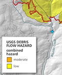 |
New WALERT debris flow report on the Nakia Creek Fire
On January 18, 2023 we published a WALERT report that provides an assessment of debris flow hazard following the 2023 Nakia Creek Fire. Click here to download the report as a pdf. |
|
 |
New Mines and Minerals database
On January 10, 2023 we released a database that consolidates our existing mines and minerals data. Click here to view the database on the Geologic Information Portal or here to download the zip file. |
|
 |
New lidar images
On January 4, 2023 we released a new collection of lidar images showing places of geologic interest across the state. Click here to read more or here to browse the images. |
|
2022(top) |
||
 |
New geologic map for the Chester Morse Lake quadrangle
On December 15, 2022 we released a new geologic map of the Chester Morse Lake quadrangle at a scale of 1:24,000. Click here to download the map and pamphlet. |
|
 |
New geologic map for the Colockum Pass SE quadrangle
On December 15, 2022 we released a new geologic map of the Colockum Pass SE quadrangle at a scale of 1:24,000. Click here to download the map and pamphlet. |
|
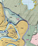 |
New map of the McKenna and Lake Lawrence quadrangles
On December 15, 2022 we released a new geologic map of the McKenna and northern half of the Lake Lawrence quadrangles at a scale of 1:24,000. Click here to download the map and pamphlet. |
|
 |
New interactive map for recently reported landslides
On November 16, 2022 we released a new interactive map showing recently reported landslides. Click here to go to the map. Read more about landslides on our landslides webpage. |
|
 |
Tsunami walk maps for Grayland and North Ocean Shores
On October 6, 2022 we released new tsunami evacuation walk time maps for Grayland and North Ocean Shores. Click Grayland or Ocean Shores to download the maps. Click here to check out other available walk maps. |
|
 |
New WALERT report published
On October 5, 2022 we released a new Wildfire-Associated Landslide Emergency Response Team report for the Bolt Creek, Suiattle River, Boulder Lake, and Lake Toketie fires. Click here to download the report. |
|
 |
Tsunami walk map for the Tokeland Peninsula
On August 4, 2022 we released a new tsunami evacuation walk time map for the Tokeland Peninsula. Click here to download the map. Click here to check out other available walk maps. |
|
 |
Snohomish landslide inventory
On July 28, 2022 we released a landslide inventory for Snohomish County. Click here to read the report and go to the Geologic Information Portal to see the data. |
|
 |
Tsunami interactive web guide
On July 11, 2022 we released an educational web guide for the tsunami content on our website that includes an additional capstone project to synthesize learning and a data component with real data. Click here for access. |
|
 |
Simulation videos for a Seattle Fault earthquake
On July 7, 2022 we released new tsunami modeling results for a large Seattle Fault earthquake scenario. There are six simulation videos to show how the tsunami impacts would change over time. Click here to view them. |
|
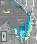 |
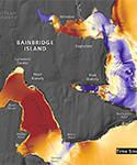
Tsunami hazard maps for a Seattle Fault earthquake
On July 7, 2022 we released new tsunami modeling results. Click here to download the report and the 16 map sheets that display impacts from a tsunami generated by a large Seattle Fault earthquake scenario. |
|
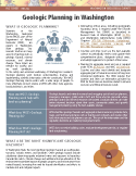 |
Geologic Planning in Washington fact sheet
On June 29, 2022 we released a new fact sheet about geologic planning and WGS efforts to help connect our science to communities. Click here to access the fact sheet. |
|
 |
Geologic Planning webpage
On June 7, 2022 we released a new webpage about geologic planning and WGS efforts to help connect our science to communities. Click here to access the page. |
|
 |
Updated Aggregate Resources webpage
On June 7, 2022 we released an update to our Aggregate Resources webpage, that includes new information about planning for aggregate needs under the Growth Management Act. Click here to access the page. |
|
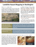 |
Landslide Hazard Mapping in Washington fact sheet
On June 7, 2022 we released a new fact sheet about landslide hazard mapping in Washington and how it can help with land-use planning. Click here to view the fact sheet. |
|
 |
Earth science educational resources webpage
On May 27, 2022 we released a new webpage to search for and download earth science educational resources for K–12 classrooms, with a focus on Pacific Northwest geology. Click here to access the page. |
|
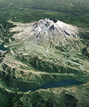 |
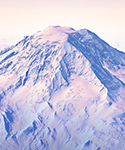
Bird's-eye view map poster of Mount St. Helens
On May 17, 2022 we released a new poster that chronicles the changes of and surrounding Mount St. Helens as a result of the catastrophic May 18, 1980 eruption. Click here to access the map. |
|
 |
New Frequently Asked Questions webpage
Do you have questions? We've got answers! On May 17, 2022 we released a new webpage that answers all of the questions we get asked most frequently. Click here to go to the page. |
|
 |
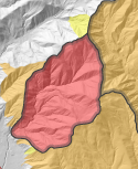
Surficial geologic map for Sadie Creek fault, Clallam County
On May 11, 2022 we released a 1:10,000-scale surficial geologic map for Sadie Creek fault in Clallam County. Click here to view this map. |
|
 |
Updated GIS data for 1:250,000-scale geologic maps
On May 9, 2022 we released an updated digital dataset for our 1:250,000-scale surface geology of Washington to align with new federal data standards. Click here to download this new data. |
|
 |
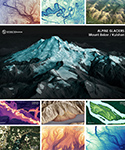
Updates to webpage on Washington's Glacial Geology
On April 25, 2022 we updated some of the content on our webpage about Washington's Glacial Geology. Check out the new sections Alpine Glaciers and Future of Washington's Glaciers. |
|
|
New GIS data for 1:25,000 to 1:99,000 geologic maps
On April 4, 2022 we released a new dataset on our Geologic Information Portal, which can be viewed and downloaded here. The initial release includes 10 maps but many more will be added soon. |
|
 |
Aggregate resource mapping fact sheet
On March 31, 2022 we released a new fact sheet that explains how WGS can help counties and cities with their land-use planning by providing aggregate resource maps. View the fact sheet here. |
|
|
Updated GIS data for 1:500,000-scale geologic maps
On February 11, 2022 we released an updated digital dataset for our 1:500,000-scale surface geology of Washington. Click here to download this new data. |
|
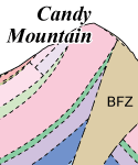 |
Geologic maps of Badger and Candy Mountains
On February 3, 2022 we released new geologic maps for Benton County's Badger Mountain Centennial Preserve and Candy Mountain Preserve. Click here to download these new maps. |
|
 |
Tsunami Evacuation Maps
On January 26, 2022 we released new tsunami evacuation maps for coastal areas of Pacific County and Anacortes from an extended L1 Mw 9.0 Cascadia subduction zone megathrust earthquake scenario. |
|
 |
Olympic Peninsula Tsunami Hazard Maps
On January 10, 2022 we released new tsunami modeling results for the Olympic Peninsula from an extended L1 Mw 9.0 Cascadia subduction zone megathrust earthquake scenario. |
|
2021(top) |
||
 |
1:24,000-Scale Geologic Maps
On December 15, 2021 we released geologic maps for Tenalquot Prairie and the northern two-thirds of the Vail quadrangles and Colockum Pass SW and the southern half of Naneum Canyon quadrangles. |
|
 |
Lidar Image Map
On December 3, 2021 we released a new interactive map that features high resolution lidar images for 60 areas across the state. Click here to peruse the map and check out our lidar page to learn more. |
|
 |
WALERT Report: Twentyfive Mile Fire
On November 9, 2021 we released a report that evaluates the risk to communities and infrastructure from post-wildfire landslides and debris flows near Chelan, Chelan County. Click here for the report. |
|
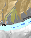 |
WALERT Report: Muckamuck Fire
On November 4, 2021 we released a report that evaluates the risk to communities and infrastructure from post-wildfire landslides and debris flows near Conconully Lake. Click here for the report. |
|
 |
WALERT Report: Schneider Springs Fire
Our November 2, 2021 report evaluates the risk to communities and infrastructure from post-wildfire landslides and debris flows near Naches, Yakima County. Click here for the report. |
|
 |
WALERT Report: Ford Corkscrew Fire
Our September 15, 2021 report evaluates the risk to communities and infrastructure from post-wildfire landslides and debris flows near the towns of Tumtum and Ford in Stevens County. Click here for the report. |
|
 |
WALERT Report: Cedar Creek and Cub Creek 2 Fires
Our September 8, 2021 report evaluates the risk to communities and infrastructure from post-wildfire landslides and debris flows near the towns of Mazama and Winthrop. Click here to read the report. |
|
 |
WALERT Report: Lick Creek and Silcott Fires
On August 27, 2021 we released a report evaluating the risk to communities and infrastructure from post-wildfire landslides and debris flows near Asotin and Garfield Counties. Click here to read the report. |
|
 |
WALERT Report: Red Apple Fire
On August 11, 2021 we released a report evaluating the risk to communities and infrastructure from post-wildfire landslides near Wenatchee, Chelan County. Click here to read the report. |
|
 |
WALERT Report: Chuweah Creek Fire
On August 4, 2021 we released a report evaluating the potential risk to water tanks from post-wildfire landslides in the community of Nespelem, Okanogan County. Click here to read the report. |
|
 |
Field Notebook Collection Story Map
On July 26, 2021 we launched a new story map about our data preservation efforts. The story map features our digital, geolocated field notebook collection. Click here to view it. |
|
 |
Results of 2019–2021 School Seismic Safety Project
On July 12, 2021 we published the second phase of a statewide effort to systematically evaluate Washington school buildings for seismic performance. Click here for more information. |
|
 |
Updated Pagesize Geologic Map of Washington
On May 13, 2021 we released an updated popular handout that includes a simplified geologic map of Washington on the front and a short summary of the geologic history of Washington on the back. |
|
 |
Volcano Interactive Web Guide
On May 13, 2021 we published an interactive web guide to our volcano website content that is meant to be an educational resource. Click here to access this resource and related educational content. |
|
 |
Washington 100 Geotourism Website
On May 10, 2021 we released a new geotourism website that tells the geologic stories of 100 great places to see geology in Washington. Click here to go to the website and start exploring! |
|
 |
Tsunami Hazard Maps of the Puget Sound
On April 26, 2021 we published new tsunami hazard maps of the Puget Sound and adjacent waters, showing modeled tsunami inundation and current speed. Click here to download the maps and pamphlet. |
|
 |
Carbon Sequestration Fact Sheet
On February 10, 2021 we published a fact sheet about geologic carbon sequestration. Learn about this process and what it might mean for Washingtonians. Click here to download the fact sheet. |
|
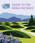 |
Guide to the Mima Mounds
On February 9, 2021 we published a booklet about the Mima mounds. Learn about this protected landscape and the many hypotheses for how it formed. Click here to download the booklet. |
|
 |
New Groundwater Webpage
On January 27, 2021 we published a new webpage about groundwater and its importance as a resource for communities across Washington. Click here to visit the page. |
|
 |
New Carbon Sequestration Webpage
On January 27, 2021 we published a new webpage about geologic carbon sequestration, its importance as a method to mitigate global warming, and how it could be used in Washington. Click here to visit the page. |
|
2020(top) |
||
 |
TsuInfo Alert Newsletter
On December 29, 2020 we released the latest TsuInfo Alert, a bi-monthly newsletter about the latest tsunami research. Click here to download the newsletter, or visit our TsuInfo Alert page to access older editions. |
|
 |
Newly Published Geologic Maps
On December 21, 2020 we released two 24k maps of quadrangles covering (1) Ellensburg North and part of Reecer Canyon and (2) Oakville and Rainbow Falls. Click here for map 1 and here for map 2. |
|
 |
Tsunami Hazard Maps and Videos Fact Sheet
On December 16, 2020 we released a new fact sheet to explain our different types of tsunami hazard maps and videos. Click here to view the fact sheet, and check out our tsunamis page to learn more. |
|
 |
WALERT Report for the Evans Canyon Fire
On December 14, 2020 we released a new Wildfire-Associated Landslide Emergency Response Team (WALERT) Report for the Evans Canyon Fire. Read more about wildfire-associated landslides on our WALERT page. |
|
 |
Alluvial Fan Flyer
On October 15, 2020 we published a new flyer about alluvial fans which are particularly susceptible to post-fire flooding. Click here to download a copy. |
|
 |
Tsunami Simulation Videos
On August 27, 2020 we released videos for Grays Harbor, Willapa Bay, and zoomed-in videos for the northern and southern portions of Willapa Bay. Click here to view the videos. |
|
|
New TsuInfo Alert newsletter
On July 1, 2020 we released the latest TsuInfo Alert, a bi-monthly newsletter about the latest tsunami research. Click here to download the newsletter, or visit our TsuInfo Alert page to access older editions. |
|
 |
Homeowner's Guide to Earthquakes booklet
On June 24, 2020 we published our homeowner's guide to earthquakes, a booklet about how to prepare your home and your family for earthquake hazards. Click here to download a copy. |
|
 |
New Historical Field Notebook collection
On June 8, 2020 we released our historical field notebook collection. This collection includes theses, maps, and publications from 1899 onward. Click here to visit the page and browse these historical resources. |
|
 |
New Education and Outreach website
On May 14, 2020 we launched our new Education and Outreach page to share educational resources and discuss outreach opportunities. Click here to visit the page. |
|
 |
New webpage about the Washington Geological Survey
On April 9, 2020 we published a new webpage about our mission, our history, and all the important work we do in the office and the field to provide geologic information to the people of Washington. |
|
 |
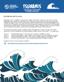
New brochure: Tsunami hazards in Washington State
On March 31, 2020 we released a tsunami brochure for residents in Washington to understand and prepare for tsunami hazards. |
|
 |
New fact sheet for the Washington Lidar Program
On March 31, 2020 we released a fact sheet for the Washington Lidar Program. Click here to learn more about the Lidar Program and check the Lidar Portal to view and download the latest lidar data. |
|
 |
Updated landslide inventory for western Whatcom County
On February 27, 2020 we released an updated landslide inventory for western Whatcom County. Click here to download the publication, or visit our Geologic Information Portal to access all of our landslide data. |
|
2019(top) |
||
 |
New 1:24,000-scale geologic mapping released
On November 22, 2019 we released an update to our 1:24,000-scale geologic mapping. Visit our Geologic Information Portal to view and download the data. |
|
 |
We have a new State Geologist!
Casey Hanell joined the Washington Geological Survey on October 1, 2019 as our new State Geologist. For more information about Casey read his profile. |