
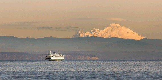
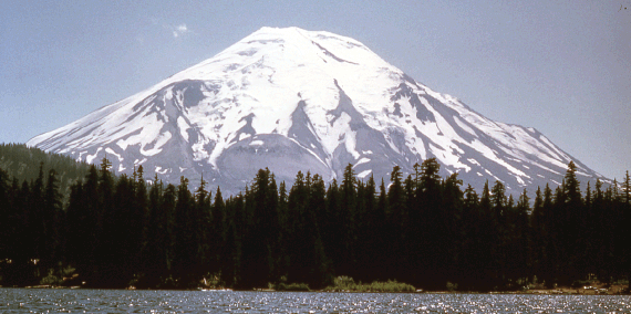
Washington has five volcanoes that are listed as high or very high threat potential: Mount Baker, Glacier Peak, Mount Rainier, Mount St. Helens, and Mount Adams. These volcanoes are part of the Cascade Range, a 1,200-mile line of volcanoes from British Columbia to northern California.
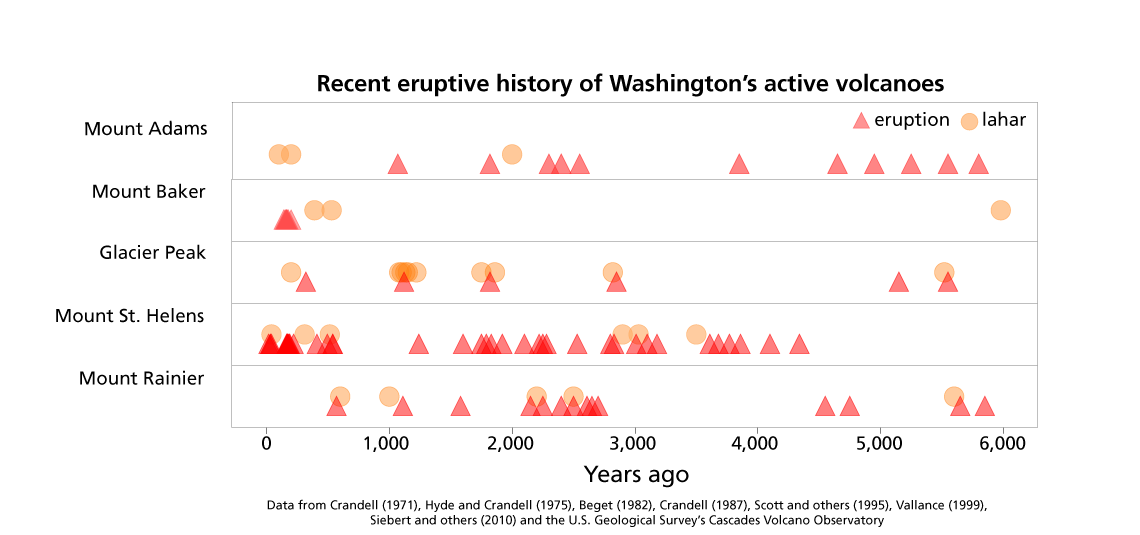
Many volcanoes in Washington are active and have had recent eruptions. Volcanoes do not erupt at regular intervals, so it is difficult to know exactly when or where the next eruption will happen.
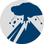
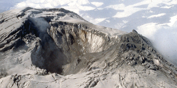
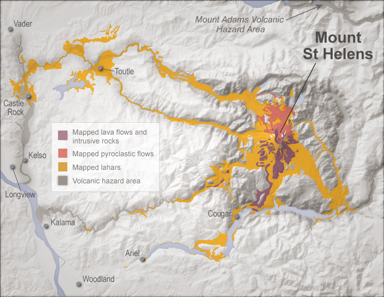
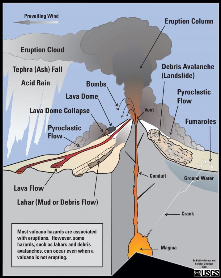
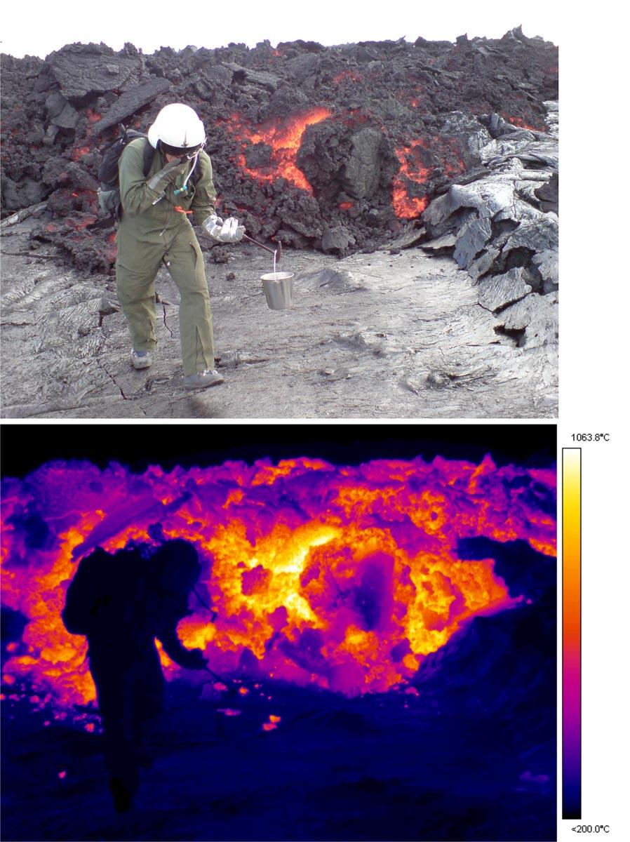
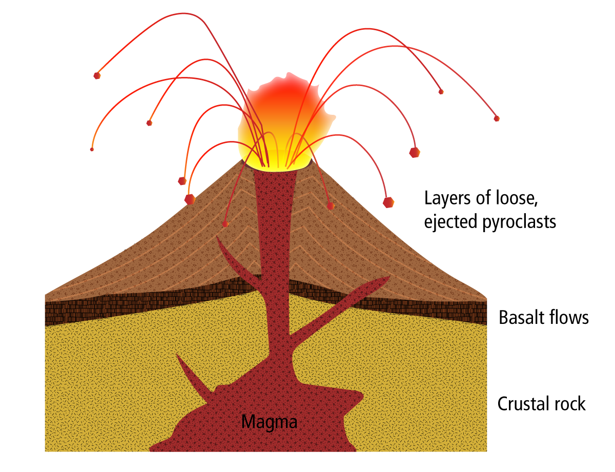
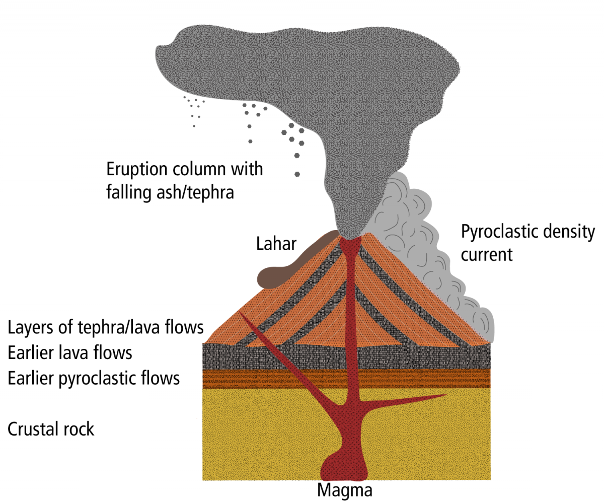
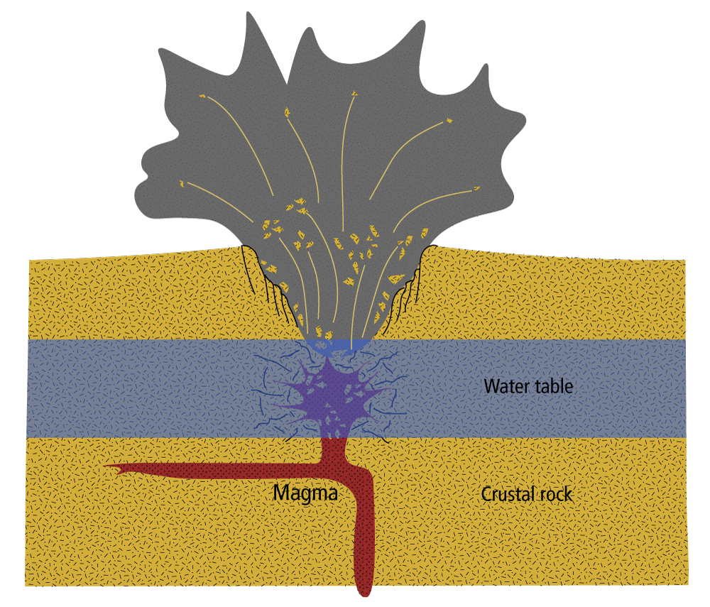
Many hazards come with living near volcanoes. Volcanic eruptions can send ash and volcanic debris into the air. Heat from the volcano can melt snow or ice and cause dangerous mudflows and debris flows called lahars. Molten rock called lava can erupt and flow downhill, destroying everything in its path.
How dangerous are the Northwest's volcanoes? Video by Oregon Public Broadcasting.
Volcanoes are also beautiful mountains that many people visit each year for recreation. Volcanoes are the most visual result of plate tectonics and are one of the few places on Earth where molten rock can reach the surface. There are even old volcanoes on other planets, such as Venus and Mars.
Click below to learn more about volcanoes, their hazards, who is at risk, and how to prepare for an emergency.
 Washington volcanoes |
 Volcanic hazards |
 Evacuation and preparation |
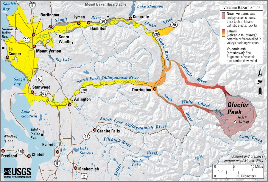
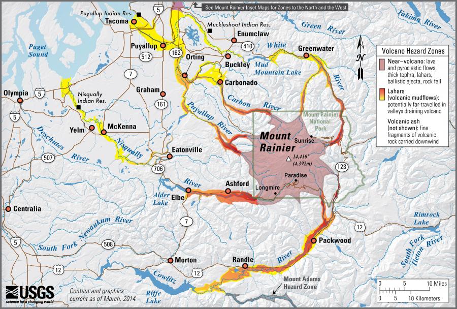
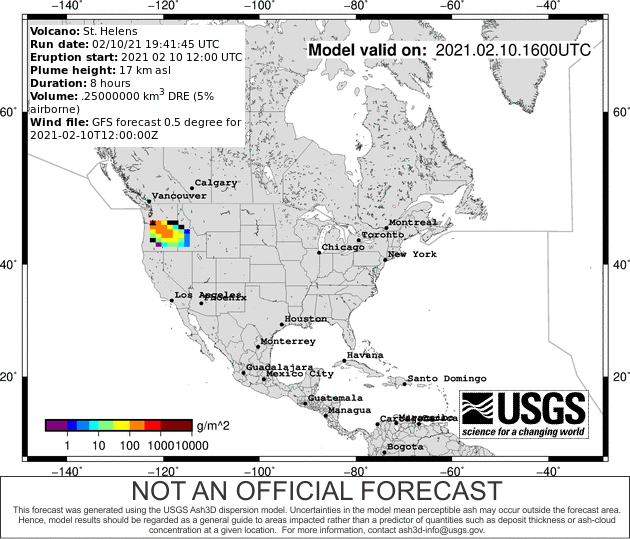
 Volcano hazard information map |
 Understand volcanoes |
 What we do |
 Volcano preparedness products |
 Fun volcano activities |
Washington volcanoes
- Mount Baker
- Glacier Peak
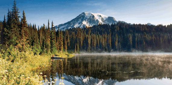
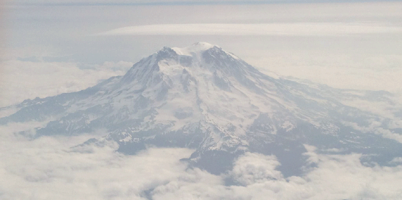
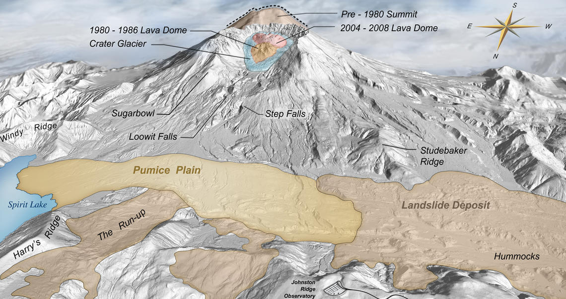
- Mount Rainier
- Mount St. Helens
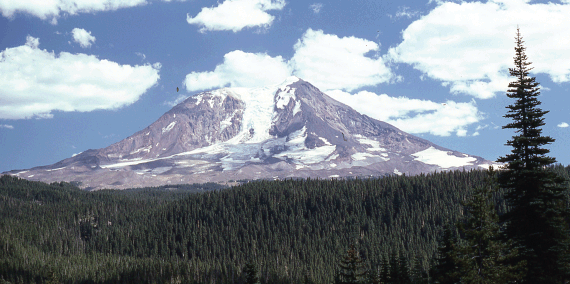
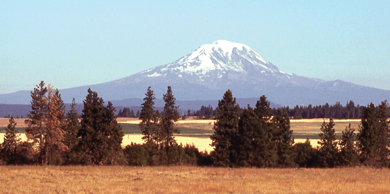
- Mount Adams
-

Geology
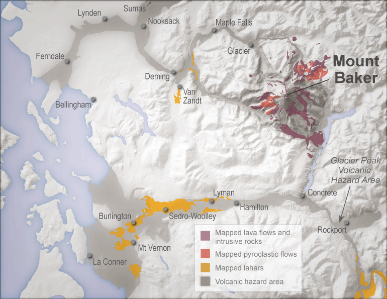
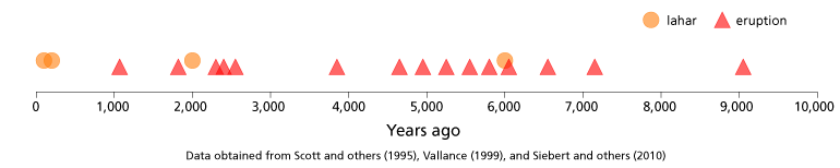
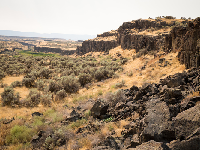
Mount Baker produces andesitic lava flows, pumice, and lahars (volcanic mudflows).
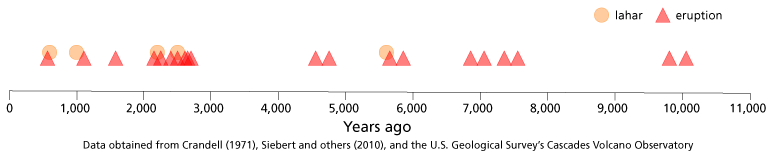
Eruption and Lahar History
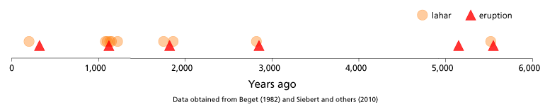
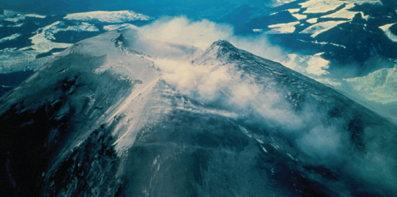
Mount Baker is one of the youngest Cascade volcanoes, and erupts infrequently. Its last major eruptive period occurred about 6,600 years ago, where large portions of the flank repeatedly collapsed generating massive lahars. There are additional reports of eruptions and lahars from the 19th century, and as recently as 1975, fumarole activity and snow melt ramped up dramatically for several years.

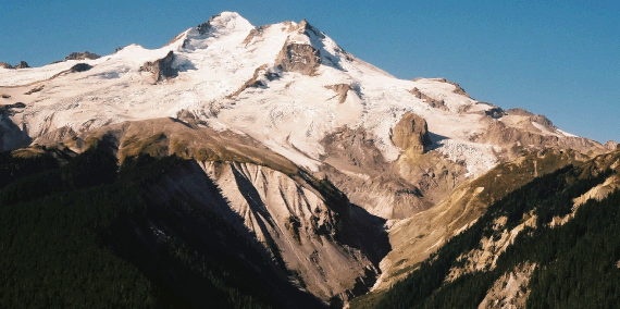
Steam and gas still issue from both Sherman Crater and the Dorr fumarole field on the northeast flank of the volcano today. Mount Baker holds the world record for most snowfall in a single season—95 feet in 1999!
Short visual tour of Sherman Crater, Mount Baker summit fumarole field. Video by Dave Tucker.
Links
Simplified
Hazard MapMore Info
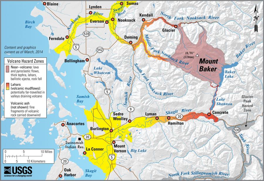
Potential Volcanic Hazards from Future Activity at Mount Baker Local Resources


Volcanic hazards
- Who is at risk?
- Hazard types
- Monitoring


Evacuation and Preparation
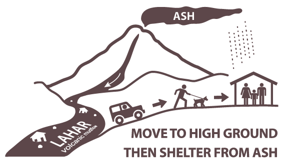
Volcanic eruptions and lahars are frightening natural disasters. It is important to prepare ahead of time.
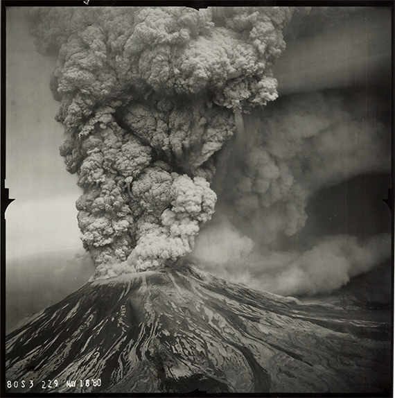
The eruption of Mount St. Helens on May 18, 1980 killed 57 people, destroyed 27 bridges and almost 200 homes, and caused disruption for thousands of people. You can minimize damage and loss of life by being prepared for a volcanic emergency. One of the most important things you can do is learn about your risks.
The following information is synthesized from the Cascade Volcano Observatory, Washington Emergency Management Division, and Ready.gov web sites.
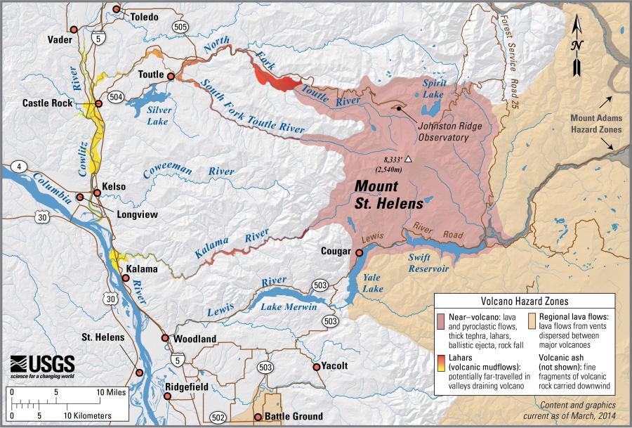
More information about volcanic hazards and preparedness can be found in the Volcano Hazard Information Map
Before an Eruption
- Learn about your risks—Know the danger and hazards you face at home, at work, and where you relax, adventure, or travel.
- Plan ahead. Have emergency supplies, food, and water stored.
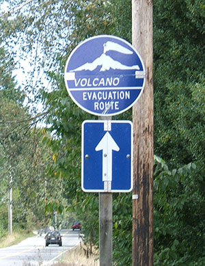
- Plan an evacuation route away from streams that may carry lahars or landslide debris.
- Make sure your emergency provisions contain a pair of goggles and disposable breathing masks for ash and dust.
- Make a family emergency plan so that you know how to contact your family members in case of an emergency.
- Stay informed: Listen to media outlets for warnings and evacuations. Listen for All Hazard Alert Broadcast sirens that warn of lahars. Check out the Volcano Notification Service to subscribe to alerts about specific volcanoes.
- Ask local and state emergency offices and schools about their response plans. Be prepared to follow official guidance.
Be informed. Make a plan. Build a kit. Educate and protect your family, neighbors, and friends.
During an Eruption
- Follow evacuation orders issued by authorities. Evacuate immediately from an erupting volcano!
- Be aware that lahars and other types of landslides or debris flows can travel great distances from the volcano. Avoid river valleys and other low-lying areas that may be prone to these hazards.
- If you are in a lahar hazard zone and become aware of an oncoming lahar, get to high ground and then shelter in place. If there are signs for evacuation routes, follow them.
- Stay informed: Watch and/or listen for additional information.
- Listen for All Hazard Alert Broadcast sirens that warn of lahars.
- Do your part to remain safe and help others in need.
If There is Ashfall...
Protect your lungs!
Volcanic ash is made of microscopic shards of glass and other fine-grained material. Ash can can cause significant damage to animals, including significant damage to lungs or asphyxiation if inhaled.
- If there is falling ash and you cannot evacuate, remain indoors with doors, windows, and ventilation systems closed until the ash settles.
- Help infants, the elderly, and those with respiratory conditions.
- Wear a respirator, face mask, or a use a damp cloth across your mouth to protect your lungs.
- Use goggles, and wear eyeglasses instead of contact lenses.
- Avoid driving in heavy ash fall unless absolutely required. If you must drive, reduce your speed significantly.
- Avoid operating engines of any kind. Ash can clog engines, damage parts, and stall vehicles.
- Wear long-sleeved shirts and long pants.
- Keep roofs free of ash in excess of 4 inches.
- Limit outdoor activity. Remove outdoor clothing before entering a building.
- Check to ensure that ash does not contaminate your water. If it does, use a different source, such as bottled water.
- For more information about ash fall, check out the USGS Volcanic Ash website.
After an Eruption
- Go to a designated public shelter or evacuation area if you have been told to evacuate or you feel it is unsafe to remain in your home. Text SHELTER + your ZIP code to 43362 (4FEMA) to find the nearest shelter in your area (example: shelter 98506)
- Stay informed: Watch and/or listen for additional information. Listen to NOAA Weather Radio, watch TV, listen to the radio, or check the internet for official instructions and information.
- Do not approach the eruption area.
- Be prepared to stay indoors and avoid downwind areas.
- Be aware of lahars and landslides. These hazards can occur long after the main eruption.
Volcano Hazard Information Map
Click on the volcano icons below to find lots more online resources to inform you about emergency preparedness, volcanic hazards, emergency notification systems, and evacuation plans.
Understand volcanoes
- The Ring of Fire
- What is a Volcano?
- Types of Volcanoes
- Types of Lavas


What we do
The mission of the Washington Geological Survey is to collect, develop, use, distribute, and preserve geologic information to promote the safety, health, and welfare of the citizens, protect the environment, and support the economy of Washington.
Develop hazard response plans
The Washington Geological Survey works with an inter-agency team of counties, the U.S. Geological Survey, and the Washington Emergency Management Division to develop response plans to volcanic events. This effort includes:
- Loss estimation analysis for areas near volcanoes. As of 2015, we have completed this analysis for areas near Mount Rainier.
- Loss estimation and multi-hazard analysis for all other areas near volcanoes and for all counties in Washington. These analyses are currently underway.
Work to increase public understanding
The Survey works to increase public and scientific understanding of volcanic hazards in our state through efforts such as this website, field guides, and other public outreach. We work closely with the Washington Emergency Management Division, the U.S. Geological Survey, and local counties to develop and publish educational material and information about evacuation.
Please visit our Geologic Information Portal and Geologic Hazard Maps page for the most up-to-date listing of all of our hazard maps.
|
|

|
Check out our Field Trip Guides for Mount Rainier and Mount St. Helens
|

|
Consider subscribing to our blog, Washington State Geology News, to receive notifications when new information is published. Also check out Ear to the Ground, published by the Department of Natural Resources.
Assist during times of emergency
The Survey is the lead science agency for the State during times of geologic emergency. During these times we assist other emergency planners and responders, such as the Washington Emergency Management Division, in making geologically sound decisions.
Volcano Preparedness Products
Volcanic Hazards in Washington Booklet
We have created a new booklet about volcanic hazards in Washington. Learn about lahars, how to stay safe from ashfall, and how to get information in case of an eruption. See what items you might need in your emergency kit. You can download the booklet by clicking on the image below.

También disponible en español
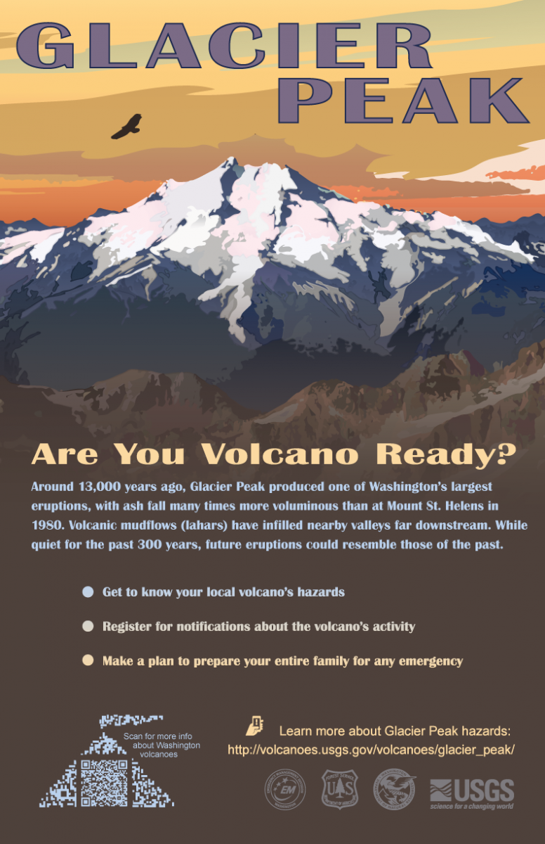
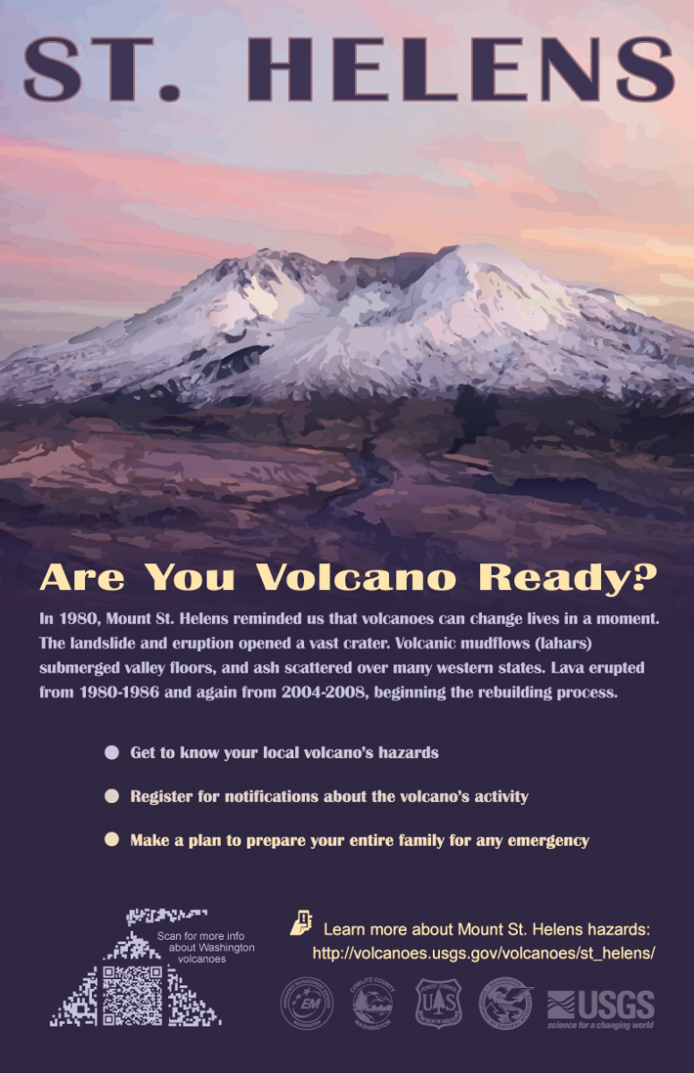
Volcano Preparedness Posters
In cooperation with the U.S. Geological Survey and several Emergency Management Departments from local counties, we have developed a series of posters to promote awareness of the hazards posed by the five active stratovolcanoes.

|
|

|
|

|
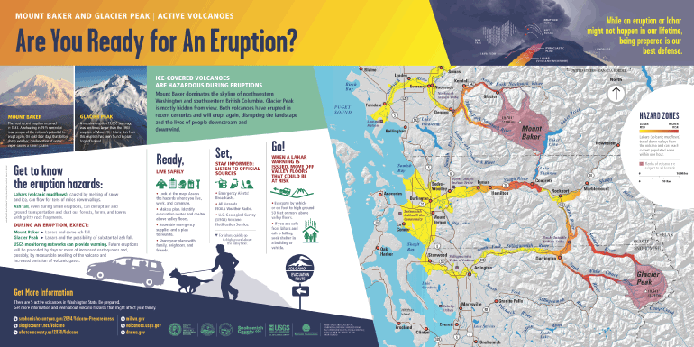
Interpretive Signs
In cooperation with the U.S. Geological Survey and several Emergency Management Departments from the state and local counties, DNR has recently developed interpretive signs that inform the public of the hazards posed by Mount Rainier, Glacier Peak, and Mount Baker. These signs are already on display in several local communities surrounding the volcanoes!
Mount Baker & Glacier Peak |
|
Mount Rainier |

|
Volcano Fun
Teacher Resources
Check out the Volcano Interactive Web Guide below, intended for middle schoolers but appropriate for all ages. This web guide will introduce you to the volcano content on the WGS website.
When you're done with the web guide, you can summarize what you learned in a creative project with the Community Hazards Plan. You can also check out the Listen Up: Monitoring Volcanoes With Sound document while you're working on the Community Hazards Plan.
|
|
|
|
Interactive
|
|
|
||
|
|
|
||
|
|
|
Videos
Drone footage of Vanuatu volcano
All about volcanoes, by SciShow Kids
