

This map shows areas of seismic risk from high (red) to low (grayish-green). The map is from a 2007 report (click here to download) on seismic design categories in Washington. The map also shows potentially active faults from a separate 2014 report (click here to download).
Earthquakes occur nearly every day in Washington. Most are too small to be felt or cause damage. Large earthquakes are less common but can cause significant damage to the things we count on in everyday life, such as buildings, roads, bridges, dams, and utilities.
Washington has the second highest risk in the U.S. of these large and damaging earthquakes because of its geologic setting. Read more below to learn about how and where earthquakes occur, what to do before, during, and after an earthquake, and what scientists are doing to learn more about them.
WHAT WE DO
The mission of the Washington Geological Survey is to collect, develop, use, distribute, and preserve geologic information to promote the safety, health, and welfare of the citizens, protect the environment, and support the economy of Washington.
Develop and publish hazard maps
The Survey has developed several types of hazard maps for different types of earthquake- and fault-related hazards:
- The Earthquake Hazards Scenario Catalog contains loss estimates for a suite of earthquake scenarios. These scenarios were selected to represent reasonable estimates of the most serious earthquake hazards everywhere in Washington as a basis for planning.
- Liquefaction susceptibility maps outline areas where water-saturated sandy soil loses strength during earthquake shaking.
- NEHRP (National Earthquake Hazards Reduction Program) site class maps outline areas where soils amplify ground shaking.
- Seismic Design Category Maps for Residential Construction were developed and published in 2007.
- Active fault maps compile all of the most recent geologic mapping in one state-wide map.
The maps are used by state and local governments to develop and update hazard-mitigation and response plans, and to mark geologically hazardous areas.
Please visit our Geologic Information Portal and Geologic Hazard Maps page for the most up-to-date listing of all of our hazard maps.
|
|

|
Find and learn about faults
The Survey conducts and publishes geologic mapping to identify and characterize faults throughout the state. The publication Faults and Earthquakes in Washington State is a state-wide compilation of active faults and folds. Each year we map additional areas and learn more about existing faults and (or) discover new ones.
Communicate earthquake hazards to the public
The Survey works to increase public and scientific understanding of fault and earthquake hazards in our state. We work closely with the Washington Emergency Management Division, the Washington Seismic Safety Committee, and the Federal Emergency Management Agency to ensure that the best-available science is used in the development of hazard mitigation plans. In addition, the Survey performs seismic safety evaluations of schools.
Consider subscribing to our blog, Washington State Geology News, to receive notifications when new information is published. Also check out Ear to the Ground, published by the Department of Natural Resources.
Assess school seismic safety
The Survey is working with the Office of the Superintendent of Public Instruction (OSPI) and Reid Middleton, an engineering firm, to perform seismic safety assessments of 220 school buildings across the state. Visit our School Seismic Safety page for more information.
WHAT TO DO BEFORE, DURING, AND AFTER AN EARTHQUAKE
Large earthquakes are likely to happen in Washington during your lifetime. Most of the populated areas of the state have a 40–80% chance of having an earthquake in the next 50 years. The most important thing you can do before the next earthquake is to prepare. An earthquake can be a scary event. The more you know what to expect, the better prepared you will be to help yourself, your family, and others around you.
- Before an earthquake
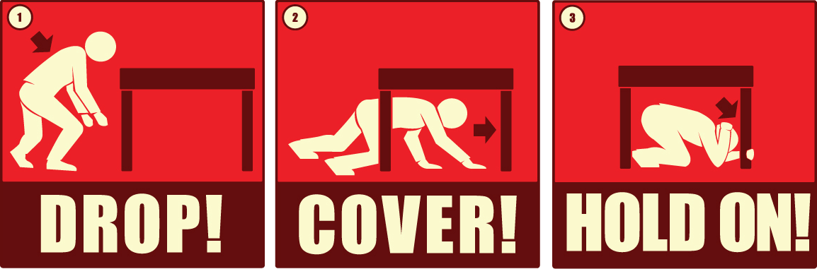
- During an earthquake
- After an earthquake
-

Know what to expect. Electricity, water, natural gas, and phones may not work. This means that the internet, your cell phone, grocery stores, and gas stations may also not work.
- Prepare to be on your own for at least three days.
- Make an emergency response plan for you and your family.
- Identify and secure items in your home or work that could cause damage. This might include flammable appliances like a water heater, tall items like book cases, or heavy pictures.
- Know what other hazards you might face. Earthquakes can trigger landslides and tsunamis which can happen after the main event. Both of these things can cause equal or greater damage than the actual earthquake.
- Participate in the yearly Great ShakeOut earthquake drills. These drills occur on the 3rd Thursday of every October. They are a great way to practice what to do when an earthquake happens.
- Consider whether earthquake insurance is right for you.


ACTIVE FAULTS AND FUTURE EARTHQUAKES
- Active faults
- Future earthquakes
- How geologists find faults

WHAT ARE FAULTS AND EARTHQUAKES?
- Faults
- Earthquake causes
- Earthquake sizes
- Prediction
- Aftershocks

HOW EARTHQUAKES CAUSE DAMAGE
Earthquakes cause damage by moving and shaking the ground, sometimes for several minutes. The shaking can damage or destroy buildings and other infrastructure. Most damage and loss of life in earthquakes is a result of ground shaking. The shaking can also cause landslides, surface ruptures, ground cracks, liquefaction, tsunamis, and seiches (standing waves). The combination of all of these effects is what makes earthquakes such a powerful geologic hazard. Do you know what to do if there is an earthquake?
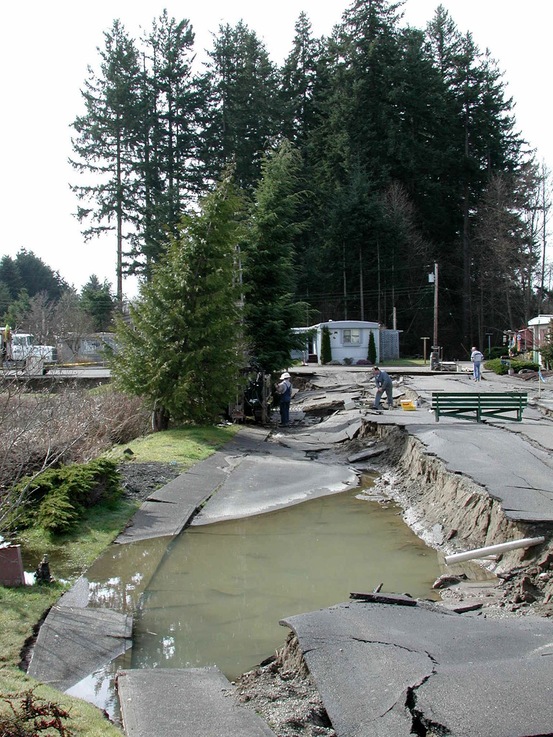
- Ground ruptures
- Ground shaking
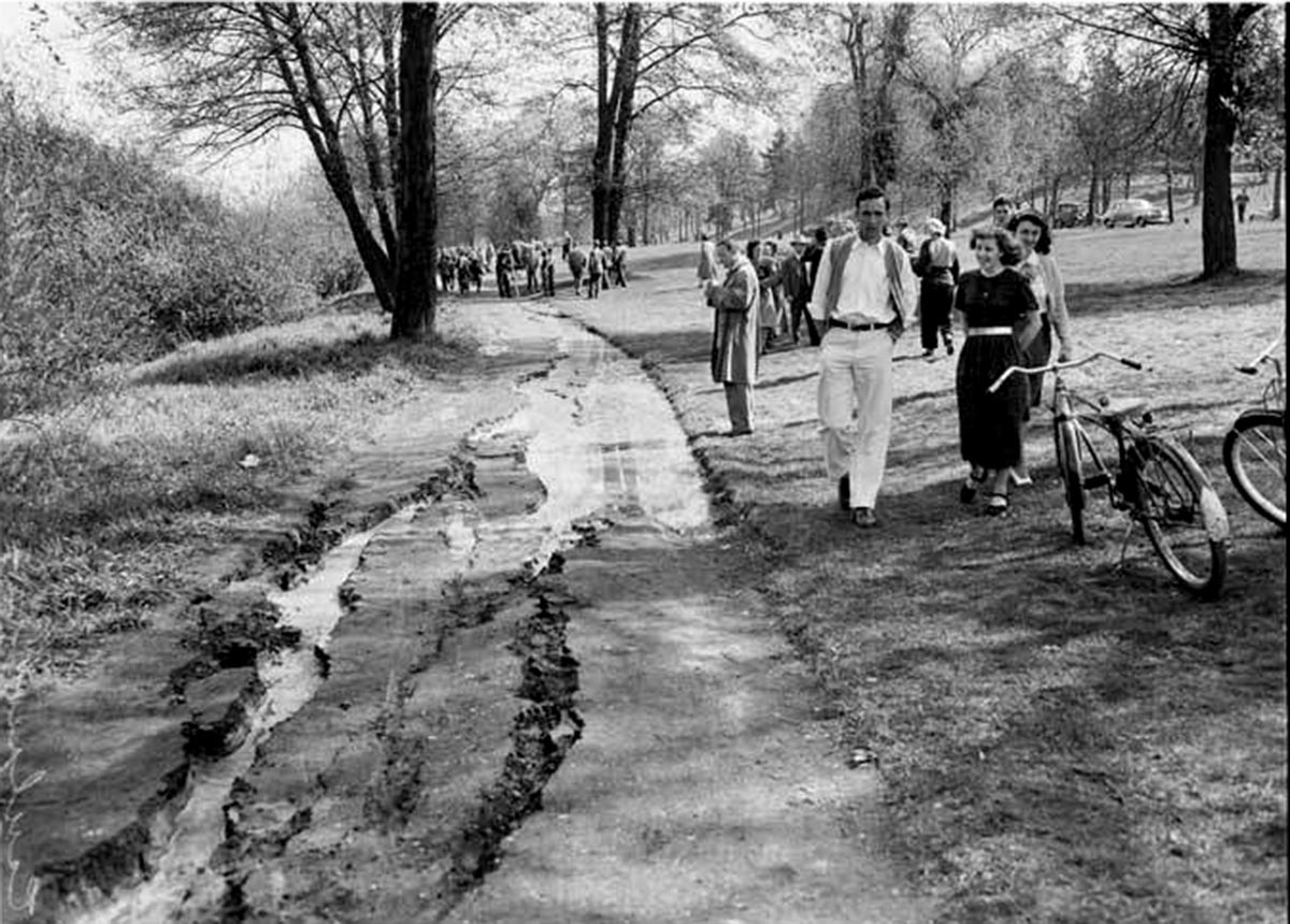
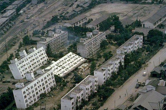
- Liquefaction
- Landslides
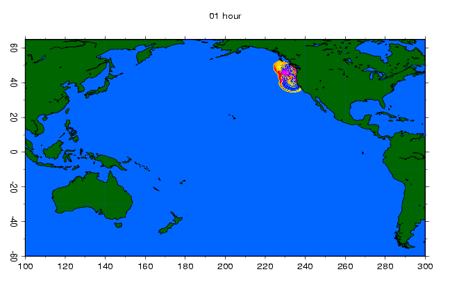
- Tsunamis


HISTORIC EARTHQUAKES IN WASHINGTON
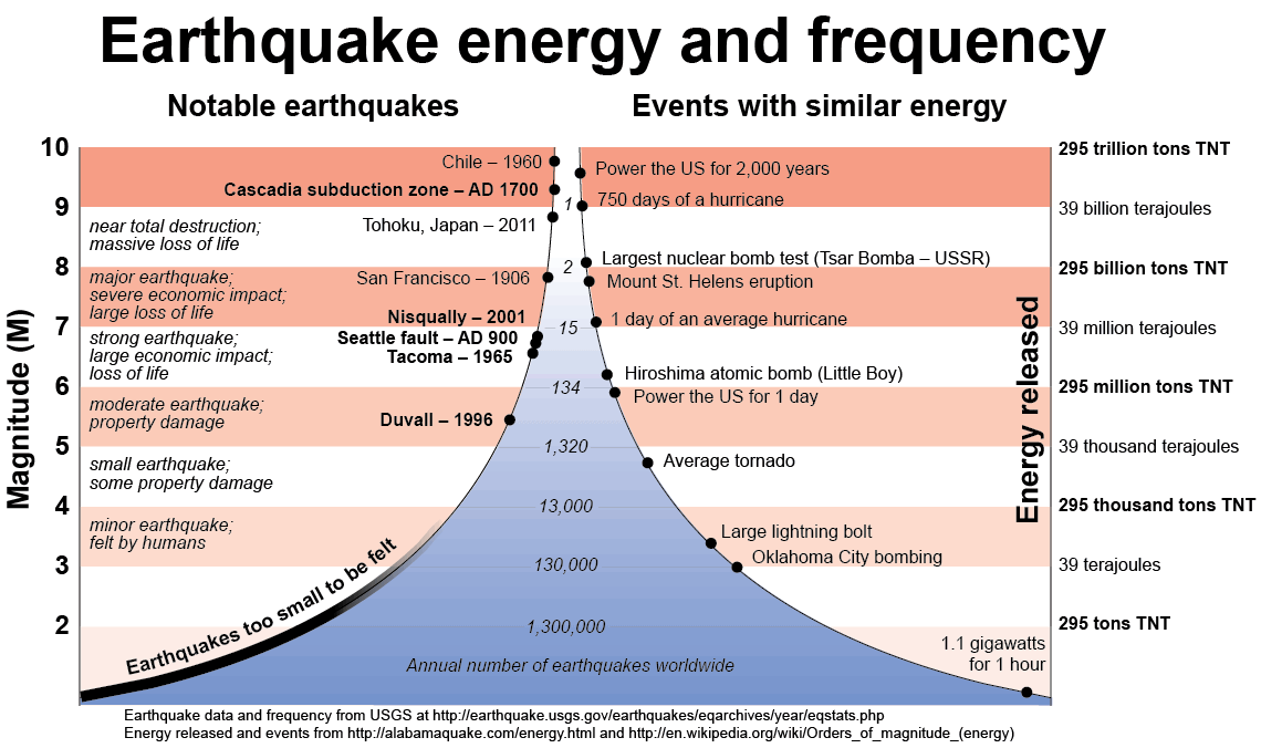
Since about 1870 there have been about 15 large earthquakes (greater than M5) in the state.
Before modern record keeping, Native Americans lived in the Pacific Northwest for thousands of years. Story telling is an important part of the Native tradition and is how their history is passed down to the next generation. Within this rich oral history there are many references to events like earthquakes and tsunamis.
Scientists have used the stories from tribes along the entire Pacific Northwest coast to learn that the last large earthquake on the Cascadia subduction zone was about AD 1700. This date was confirmed by records in Japan of an ‘orphan’ tsunami and by many lines of geologic evidence.
Stories from tribes near Seattle have also helped us to learn that the last earthquake on the Seattle fault was about AD 900–950. This earthquake caused parts of Restoration Point near on Bainbridge Island to be lifted 35 feet straight up. This movement created a tsunami in Puget Sound and triggered a large landslide into Lake Washington. When the landslide hit the water it may have created a tsunami. Radiocarbon dating and other paleoseismic methods have also confirmed this date.
EARTHQUAKE INFO FOR KIDS
Watch the video below to learn how you can be ready for the next earthquake. The video is also available in Spanish and there is a fun activity/coloring book that can be found here.
