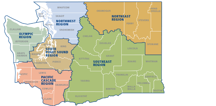
Recreation By Region
Recreation Resources
-
Hunting: WDFW Game Management Units (GMU)
-
Other agencies: Get Washington Department of Fish and Wildlife news and updates on Washington State Parks and the U.S. Forest Service.
-
How do I recreate responsibly? Visit RecreateResponsibly.org or download the #RecreateResponsibly Tip Sheet
OPEN SITES BY REGION
Get links to more information pertaining to recreation sites in DNR regions:
Northeast Region | Northwest Region | Olympic Region | Pacific Cascade Region | Southeast Region | South Puget Sound Region
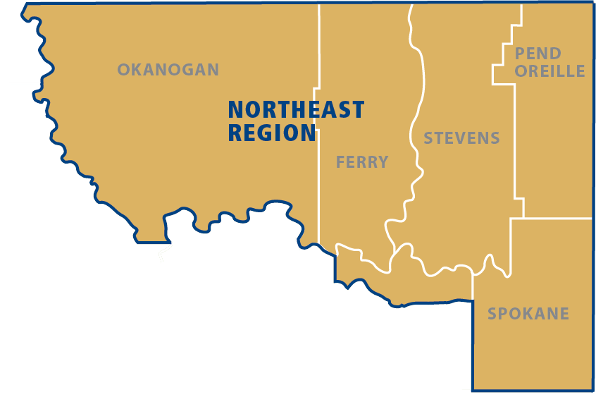
Northeast Region
Recreation alert: Dispersed campfires (those not in a designated DNR-installed fire ring at an official campground) are not permitted in Northeast Region as of April 15, 2025.
Camping
The following campgrounds are located in the Northeast region:
Chopaka Lake, Cold Springs, Douglas Falls Grange Park, Dragoon Creek, Flodelle Creek, Leader Lake, North Fork Nine Mile, Palmer Lake, Rock Lake, Rocky Lake, Rock Creek (Loup Loup), Sheep Creek, Sherry Creek, Skookum Creek, Starvation Lake, Sportsman's Camp and Toats Coulee.
State Forests
The Loomis, Loup Loup, and Little Pend Orielle State Forests allow day use and dispersed camping.
Natural Areas
Dishman Hills NRCA and Loomis NRCA.
Contact
Questions? Please call the region office at 509-684-7474.
Northwest Region 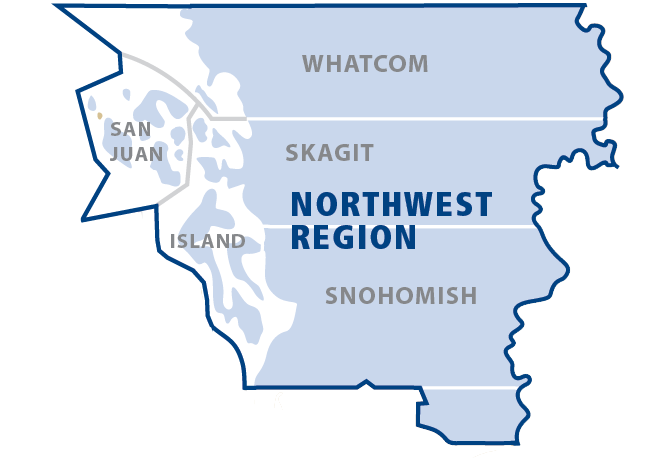
Camping
The following campgrounds are located in the Northwest region:
Beaver Plant Lake, Big Greider Lake, Cutthroat Lakes, Cypress Head, Griffin Bay, Les Hilde, Lily Lake, Little Greider Lake, Lizard Lake, Lower Ashland Lake, Lummi Island, Pelican Beach, Point Doughty and Upper Ashland Lake.
Day Use
-
Recreation sites open for day use in the Northwest region are Blanchard Mountain, Harry Osborne, North Mountain (no restrooms), Reiter Foothills and Walker Valley ORV.
-
Natural Areas and San Juan Island recreation sites include Cattle Point, Cypress Island, Lummi Island, Morning Star NRCA (snow dependent) and Griffin Bay.
Contact
Olympic Region 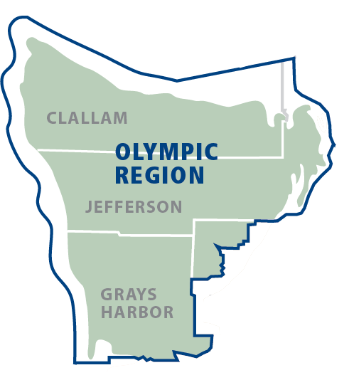
Camping
The following campgrounds are located in the Olympic region:
Bear Creek, Coppermine Bottom, Cottonwood, Hoh Oxbow, Lyre River, Minnie Peterson, South Fork Hoh, and Upper Clearwater.
Day Use
All recreation sites are open for day use only. However, forest management activities are occurring and can directly impact recreational use. Check the Olympic Region page for the most updated information.
-
Natural Areas in the region are Shipwreck Point NRCA, and Clearwater Corridor NRCA.
Recreation alert: Dry Hills area temporarily closed.
Recreation alert: Dispersed campfires (those not in a designated DNR-installed fire ring at an official campground) are not permitted in the Olympic Peninsula Forests.
Recreation alert: Damon Point is closed due to tidal conditions.
Contact
Questions? Please don’t hesitate to contact staff directly by emailing us at olympic.region@dnr.wa.gov or calling 360-374-2800.
Pacific Cascade Region 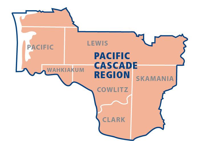
View the boundary map for Southeast and Pacific Cascade Regions.
Camping
The following campgrounds are located in the Pacific Cascade region:
Dougan Creek, Cold Creek, Rock Creek (Yacolt), Snag Lake, Tunerville, Western Lake and Winston Creek.
Day Use
-
Yacolt Burn and Elochoman State Forests are open. However, Jones Creek ORV and Hagen Creek are open seasonally from May 1 - Nov. 30.
Contact
Questions? Please call 360-577-2025.
Southeast Region 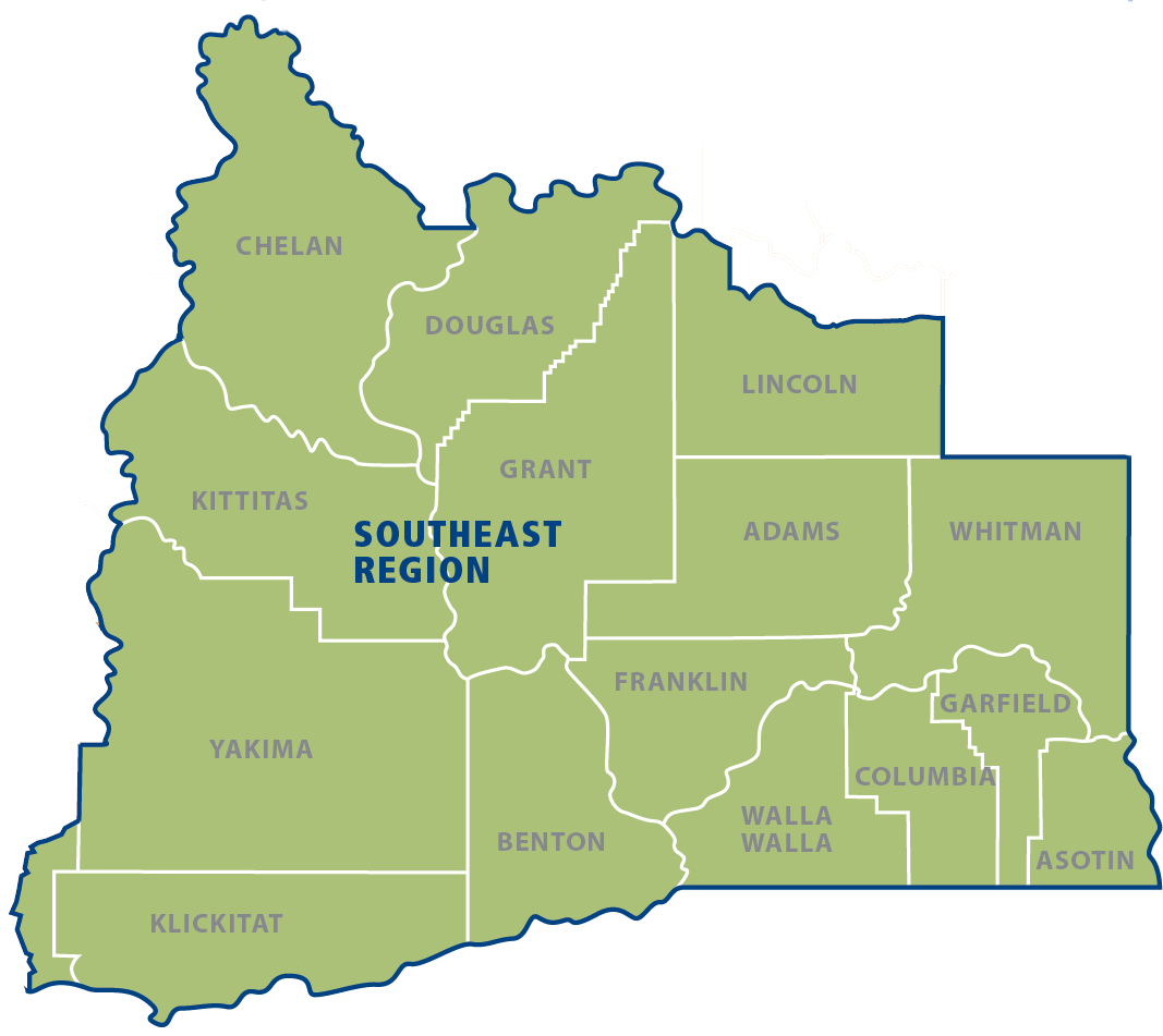
Camping
The following campgrounds are located in the Southeast region:
29 Pines, Ahtanum Camp, Ahtanum Meadows, BBQ Flats, Beverly Dunes, Bird Creek, Buck Creek dispersed, Clover Flats, Eagle's Nest, Elk Heights dispersed, Glenwood dispersed, Indian Camp, Island Camp, Naneum Ridge State Forest dispersed, Snow Cabin, Teanaway Camping Area, Tree Phones, Rattlesnake dispersed and Wenas dispersed.
Day Use
-
Recreation areas in this region are the Teanaway and Naneum Ridge (no restrooms).
-
The Natural Areas in the region are Columbia Hills NAP and White Salmon Oak NRCA.
Contact
Questions? Call us at 509-925-8510 or email southeast.region@dnr.wa.gov. View the boundary map here.
South Puget Sound Region 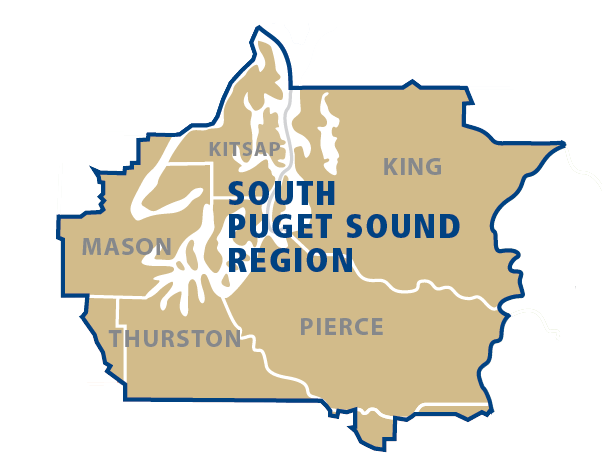
Camping
The following campgrounds are located in the South Puget Sound region:
Bruni's Snow Bowl Hut, Copper Creek Hut, Elbe Hills ORV, Elfendahl Pass Staging Area, Fall Creek, Green Mountain Horse Camp, High Hut, Kammenga Canyon, Margaret McKenny, Middle Waddell, Porter Creek, Sahara Creek Horse Camp, Tahuya River Horse Camp, Camp Spilman, and Yurt.
Day Use
Recreation areas in this region are:
Capitol Forest, Elbe Hills and Tahoma, Green Mountain State Forest, Rattlesnake Mountain Scenic Area, Raging River State Forest, Tahuya State Forest and Tiger Mountain State Forest.
Natural Areas open for recreation in the region are:
Kennedy Creek NAP, Middle Fork Snoqualmie NRCA, Mima Mounds, Rattlesnake Mountain Scenic Area, Mount Si NRCA, West Tiger Mountain NRCA and Woodard Bay NRCA.
Contact
Questions? Please call the region office at 360-825-1631.

