
Location and Natural Environment
The Olympic Experimental State Forest (OESF) is located on the western Olympic Peninsula of Washington state between the Pacific Ocean to the west, the Strait of Juan de Fuca to the north, and the high peaks of the Olympic Mountains to the east. The Washington State Department of Natural Resources (DNR) manages approximately 270,000 acres of state trust lands within the OESF’s boundaries. View a vicinity map of the area.
Rugged and Rainy
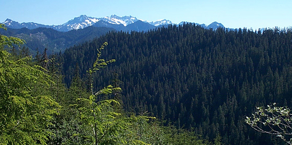
The OESF is a steep and rugged place. State trust lands range in elevation from sea level to 3,500 feet (1,066 meters).
The climate in the OESF is influenced by the Pacific Ocean. At the mid and lower elevations, temperatures are mild, snow is uncommon, and rainfall is substantial. Temperatures in the city of Forks range from about 45 degrees Fahrenheit (7 degrees Celsius) in the winter to about 72 degrees Fahrenheit (22 degrees Celsius) in the summer. Rain falls mostly between October and May, and totals can range from about 72 to 180 inches (1.8 to 4.6 meters) per year.
Abundant rain and mild temperatures support temperate rainforests in which young trees can grow 4 feet (1.2 meters) in a year. Common tree species on state trust lands include Douglas-fir, western hemlock, and Sitka spruce. Red alder and western redcedar grow in wetter areas at lower elevations. These forest types support a wide range of wildlife, including northern spotted owls, marbled murrelets, deer, elk, black bear, and many others.
With this much rain, wildfires are infrequent. The major types of natural disturbances are landslides and wind damage from powerful storms that come across the Pacific Ocean in the fall and winter.
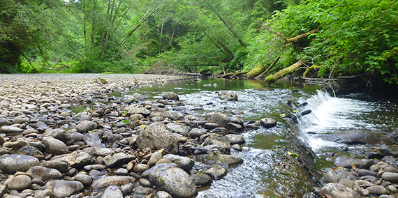
The OESF includes numerous streams and rivers. Wetlands, including bogs, are common in the bottoms of river valleys. Streams and rivers in the OESF support runs of several species of salmon and trout and non-game species such as lampreys, minnows, suckers, and sculpins.
Recreation
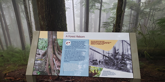
An interpretive sign along the Reade Hill trail, located near the Olympic Natural Resources Center.
In the mountains and forests of the Olympic Peninsula, DNR manages trails and a network of campgrounds that provide river or lake access for boating, fishing, and other water activities. DNR also manages Natural Resource Conservation Areas, which provide the opportunity for low-impact recreation such as hiking and bird-watching. Visit the Olympic Peninsula Forests page for more information on recreational opportunities.
